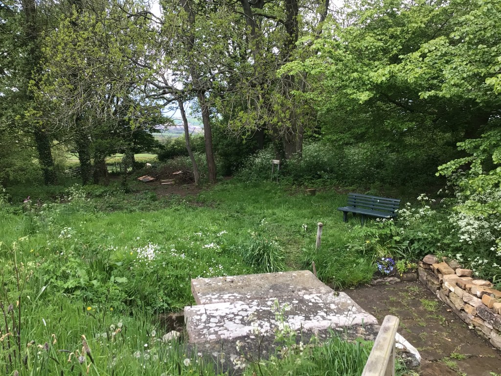


In 2017, Jet Coast Development Trust applied for grant funding on behalf of the Parochial Church Council, to improve access to the Well by adding additional stone steps, new handrails and providing a new level grass footpath from the entrance near the Port Mulgrave junction.
Hilda’s Well in the Churchyard, is the only Scheduled Ancient Monument in the parish, and was once the only water supply for the village. The waters were said to have healing properties for eye diseases, and the Well became a place of pilgrimage during the Middle Ages. According to legend, St.Hilda was asked to intercede in a drought whilst travelling through the parish. Her prayers were answered and the spring which appeared, has continued to bubble from the hillside to this day.
“Shaking Bottle Sunday” was held on Ascension Day at the Well. Local children shook well water in a small bottle containing a stick of liquorice, to produce a flavoured drink. An open air service is now held at the well every July.
St. Hilda’s Day is on 17th November
Extract from the Scheduled Ancient Monuments Listing – List entry Number: 1019161
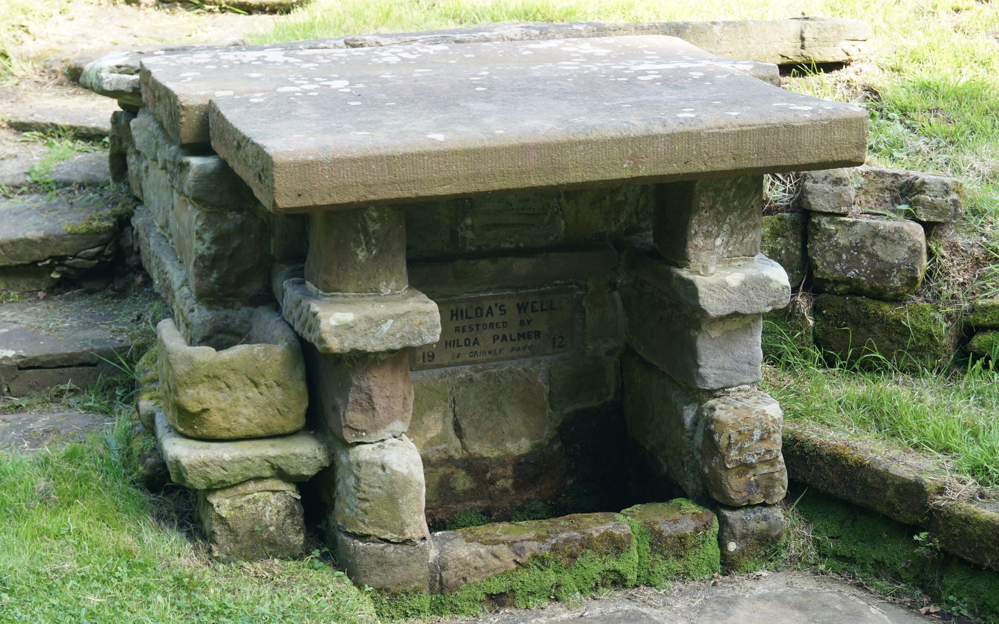
“The monument includes the remains of St Hilda’s holy well, situated at the bottom of a south facing slope in the churchyard of St Hilda’s Church. The remains, which are Listed Grade II, include a well head cover, well chamber, basin, enclosure and steps. The well head cover was restored in 1912 by Hilda Palmer, although parts of it predate this restoration. It is of sandstone construction built to 1.5m high and with two machine cut covering slabs of sandstone about 1.5m long by 0.8m wide and one weathered sandstone covering slab 2.5m long by 1.1.m wide. The modern cut covering slabs have been given fake tooling marks on their north and south ends. The west (front) slab covers the basin, a sandstone trough measuring 0.7m long, 0.45m wide and 0.2m deep. The other modern cut slab and the older sandstone slab cover the remainder of the well chamber. There is a stone paved area to the north, west and south of the well. This enclosure is defined by a dry stone retaining wall and is sub-divided into three parts by the level of the paving. The lowest section is immediately west of the opening in the well head, and is about 1.5m square. To the south of this section, raised on a two course wall is a seating area measuring 0.8m by 1.8m. The other part of the paved enclosure is situated to the north of the well head, and gives access to a flight of steps leading up a slope to the east of the well; it measures 3m by 2.3m. The well is named after St Hilda who founded the monastery at Whitby in 657. The name of the well is the root of the name of the village of Hinderwell in which it is situated. This comes from the old English Hildewella meaning Hild’s well. In the second half of the 19th century water was drawn from the well chamber by a hand pump which is marked on the Ordnance Survey second edition 1:2500 map of 1894.